Proposed Restoration Project
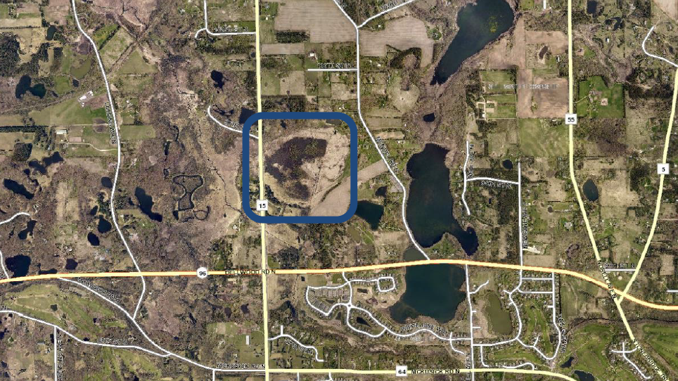
Mendel Wetland is a unique wetland in the Brown’s Creek Watershed, located between Manning Ave and Mendel Ave, north of Highway 96. This Tamarack-dominated Coniferous Bog and Fresh Meadow wetland complex artificially drains by a ditch that runs north to south through the east side of the wetland. The drainage ditch has lowered groundwater levels, resulting in peat decomposition and Tamarack bog degradation.
Coniferous bogs like Mendel Wetland are home to a variety of rare and threatened plants, and they require steady groundwater levels to maintain their defining rich peat layer. Altering groundwater by constructing drainage ditches causes the peat to degrade and threatens the health of this ecosystem.
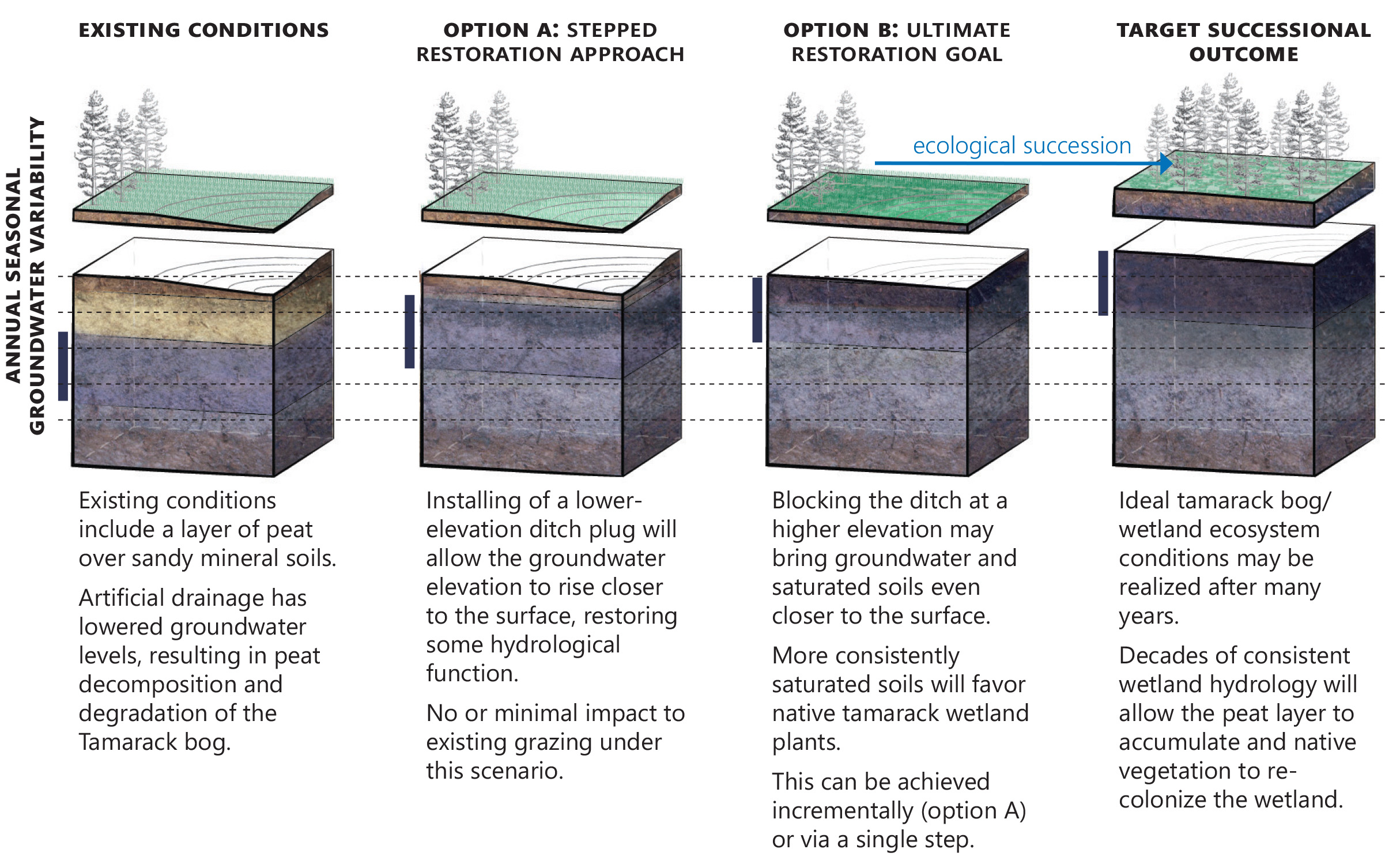
The BCWD and Washington Conservation District hope to improve the quality of the Mendel Wetland by blocking this artificial drainage to divert runoff and subsurface flow through the bog to the west, before reaching Brown’s Creek. Disabling the ditch would allow peat to slowly rebuild and plants adapted to a stable water table to gain an advantage.

Current State
While portions of the wetland are high quality, there is potential for restoration to an even higher quality. Existing conditions include:
- Degraded peat in shallower depths over a more porous or silty sand.
- Tamarack-dominated Coniferous Bog in fair condition.
- Good to excellent quality Fresh Meadow in patches, but also poor quality Fresh Meadow dominated by reed canary grass where peat has degraded to muck.
- Glossy buckthorn dominating large areas and threatening to overtake remaining Coniferous Bog.
- Shallow Marsh with good native diversity intermixed in some areas, but mostly dominated by cattail threatening to overrun it and encroach on Fresh Meadow.
- Several non-native Scots pine specimens that are relatively benign but should be removed if the wetland is enhanced or managed, and are unlikely to survive hydrology restoration.
Project Goals
Goals of the restoration project include removing or reducing the artificial drainage and managing invasive species to restore and stabilize the natural wetland hydrology.
Disabling the ditch would divert runoff and subsurface flow through the bog, before reaching Brown’s Creek. This would bring groundwater and saturated soils closer to the surface and initiate a slow paludification process (rebuilding of peat). The ditch could provide an emergency outlet if needed to protect infrastructure.
Vegetative species better adapted to a stable water table, lower nutrient, and lower pH regime, such as tamaracks, would start to gain an advantage over invasive species such as glossy buckthorn or reed canary grass and create more diversity of native plants.
In addition to blocking the drainage, vegetative management by targeting invasive species would help restore the bog more quickly, as they have a long recovery period on their own. Traditional methods of managing buckthorn and reed canary grass are labor intensive and costly, though the U of M is doing some promising research for a biological control agent for both species.
EOR recommends that BCWD prioritize hydrologic restoration by modifying the artificial drainage and continue to follow the invasive species control research, which may prove to be more cost-effective than traditional management approaches. If a wetland banking project is pursued, more aggressive management of invasives will be needed to meet pre-project designated performance standards within 5 years in order to receive credits.

Project Benefits
Disabling the drainage ditch and managing invasive species would enhance this wetland, providing benefits such as:
- Reduced nutrient and thermal loading to Brown’s Creek.
- Potential for a wetland banking project.
- Improved water filtration through bog restoration.
- Native plants adapted to a stable water table, such as Tamaracks, will gain an advantage and outcompete invasives in addition to improving native plant diversity.
Timeline & Supporting Documents
- February 2010 – BCWD Initially reached out to landowners regarding this proposed project.
- See Proposed Project Boards for history of Mendel Wetland and Brown’s Creek and project concept plans.
- September 2020 – BCWD reached out to landowners regarding two land surveys: a vegetation survey to identify plant species and quality and a topographic survey to confirm how the historic drainage affects the wetland.
- See 2020 Survey Letter for correspondence to landowners.
- December 2020 – Surveys were completed and findings were presented to the BCWD Board.
- See Mendel Road Wetland - Floristic Inventory and Site Survey Findings Memo for detailed survey findings and recommendations.
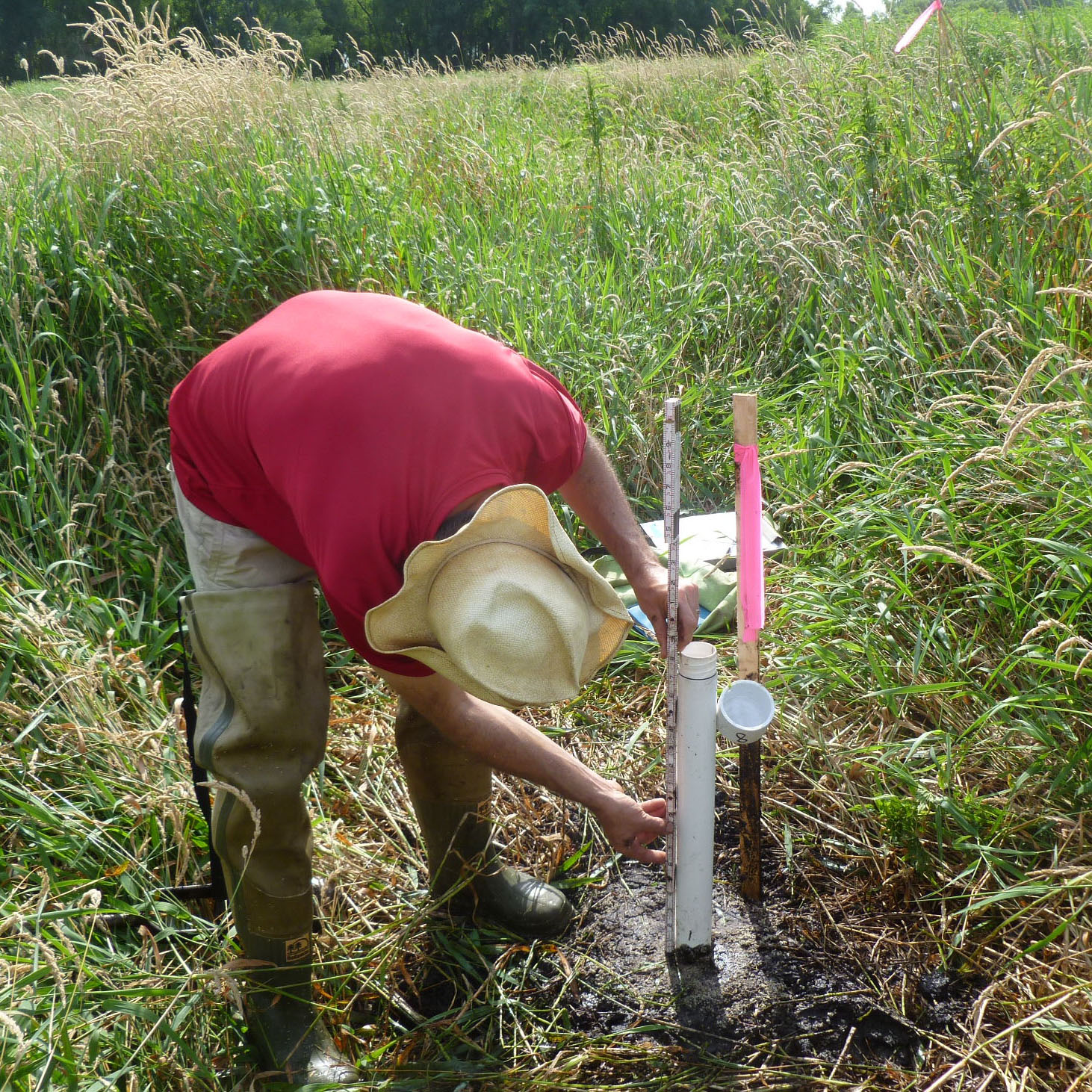
- December 2022 – Groundwater data was collected via piezometers during the growing seasons of 2021 and 2022 and shared with the BCWD Board. This was done to determine whether blocking the ditch would impact the pasture.
- See Mendel Wetland Groundwater Monitoring - 2022 Data Summary Memo for details on the groundwater data collected and the results of the study.
- October 2023 – Community engagement scope and next engineering stage were shared with the BCWD Board.
- See Mendel Road Wetland Enhancement - Scoping Next Engineering Phase Memo for details on what has been proposed, next steps, and how the project aligns with district goals.
- April 2025 – The watershed district presented the project to the landowners and did not receive unanimous support. The project will not be moving forward as of now.


